Jia Dan
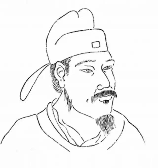
Jia Dan (730 – 805), courtesy name Dunshi, Duke Yuanjing of Wei, was the Tang dynasty's great cartographer-geographer — a general-turned-scholar who mapped the empire and the world beyond it with a precision unmatched in his century. His atlases of China, his map of the routes from China to India and Persia, and his topographical records of the post-rebellion frontier fixed the geographical knowledge on which the late Tang state, and much of later Chinese geography, depended.
Soldier and Scholar
Jia Dan came from Cang Prefecture in Hebei, from a lineage that traced itself back to the Han scholar Jia Yi, and entered government through the examinations in the 750s, just as the world he would spend his life mapping began to burn. He served as a provincial administrator through the An Lushan rebellion and its chaotic aftermath — in which, the histories note pointedly, his competence and incorruptibility made him a marked man among the corrupt — and rose steadily under the restoration emperors Suzong, Daizong, and Dezong. His career was double: as an administrator he held some of the empire’s most sensitive posts, including military governor of the Shanxi frontier circuits where the Tang faced the Tibetans and Uyghurs; as a scholar he assembled, at imperial command, the geographical archive of the age.
The Maps
His three great works defined the state of Tang geographical knowledge. The Gazetteer of the Ten Circuits (Huanying ji, presented 801) described, prefecture by prefectury, the empire’s commanderies, their distances, products, garrisons, and roads — a statistical geography of the post-rebellion state, compiled in the decades when accurate registers were scarcer than ever and therefore doubly valuable. The Map of Chinese and Foreign Territories within the Seas (Hainei huayi tu) rendered the whole known world on a grid — the Old Book of Tang records that it took him decades of assembling reports from returning envoys, merchants, and frontier officers, and that contemporaries marveled at its scale, from Annam to the Pamirs. And the Route Map from China through the Barbarian Regions to India (Guangzhou tonghai yidao), completed shortly before his death, charted the sea road from Guangzhou through the Straits to India and the Persian Gulf — the fullest early description of the maritime Silk Road in any language, preserving distances, winds, and coastlines gathered from the Arab and Persian shipmasters who then dominated the trade.
The Method and Its Sources
What made Jia Dan’s geography modern, by the standards of any century, was his sources. He did not travel the roads he mapped; he interrogated those who had. His informants included returning embassies — the Korean, Japanese, Uyghur, and Arab missions whose itineraries the court recorded — merchants of the Guangzhou trade, frontier generals with their intelligence maps, and the missionaries and pilgrims who crisscrossed Asia in the late eighth century. The New Book of Tang credits him with a vast private archive of route records and place-name cards, maintained across forty years, from which he cross-checked distances and names against the state’s own records. His surviving geographical chapters, preserved in the New Book of Tang, preserve the names and routes of the Abbasid lands — “Da Shi,” the Arab empire — as a Tang official understood them at the height of the caliphate’s power, an irreplaceable window on Tang knowledge of the western world.
Historical Assessment
Jia Dan died in 805, aged seventy-five, at the height of his honors, and the empire’s loss was permanent: much of his work survives only in excerpts and quotations, his great maps having perished with the Tang itself. Historians of cartography rank him among the supreme geographers of the pre-modern world — the equal, in range if not in survival, of Ptolemy — and historians of the Tang value him for a different reason: his maps are the documentary proof that the late Tang, for all its wars and its shrinking borders, still saw itself whole, still counted the roads to India and the gulf among its business, and still had scholars of Jia Dan’s patience to hold the empire together in ink when it could not be held in arms.
References & Historical Sources
- Old Book of Tang, biography of Jia Dan.
- New Book of Tang, biography of Jia Dan; geographical monograph (Dili zhi).
- Zizhi Tongjian, annals of Dezong.
- Paul D. Buell, “Tang international relations and the geographical imagination.”